Data Download
NARWidth is available for download as a single compressed ESRI shapefile or as segmented 4×6° lat long tiles individually available for download in the Download by Tile section below. Additionally, the 4×6° lat long tiles contain CSV-formatted tables.
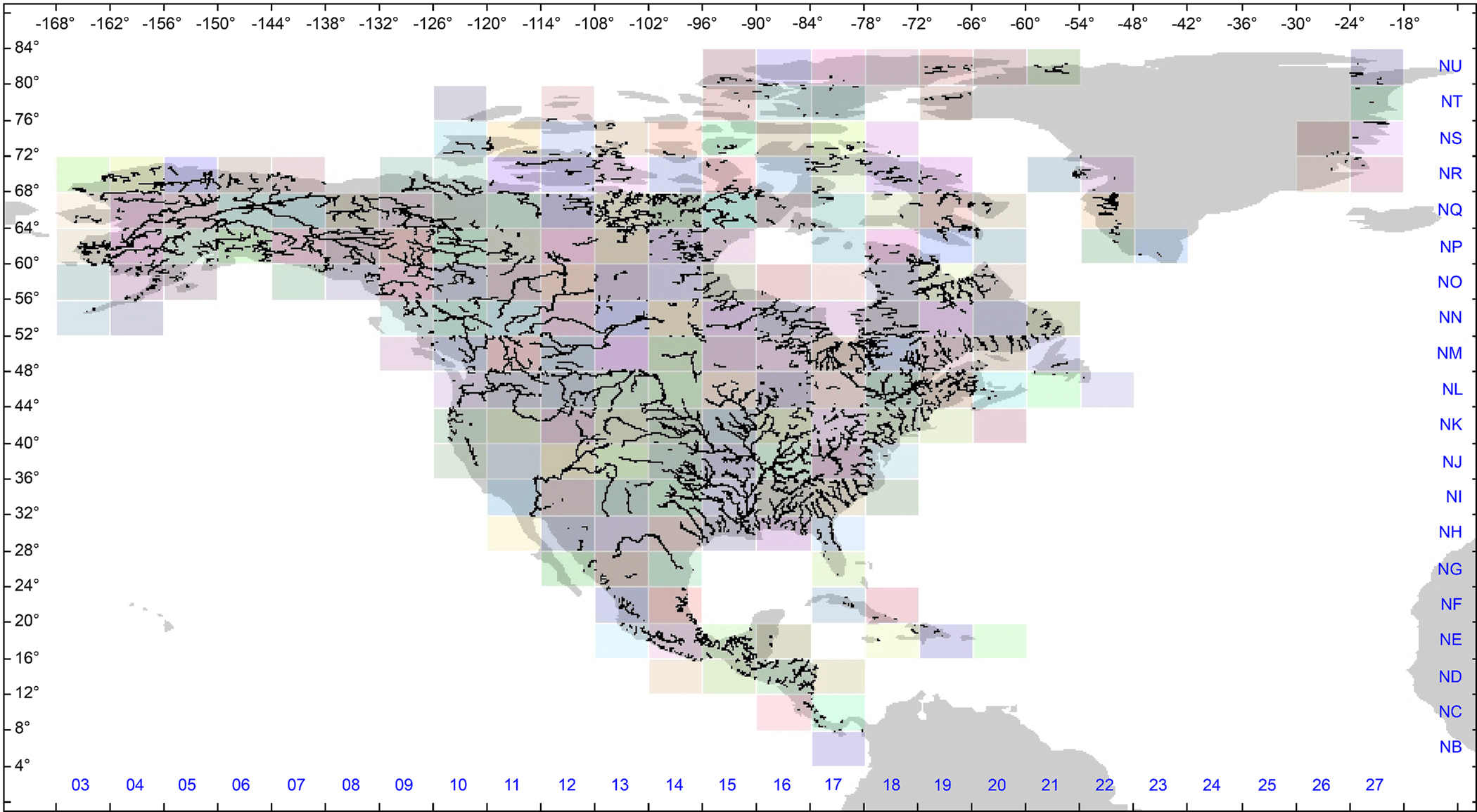
Download by Tile
Click on the image below to download individual tiles. Blue labels denote the NARWidth tile index.
Bulk Download
Download NARWidth as a single ESRI shapefile. This is a large file (~300MB) so your patience may be required.
Click here to download the enitre NARWidth Shapefile.
Citation
We ask any users to cite this data in any published material produced using this data, and if possible link web pages to the NARWidth website (http://gaia.geosci.unc.edu/NARWidth/). If NARWidth becomes a substantial part of your work, please consider adding the data set developers as coauthors. The creators of this data set retain full ownership rights over it. The data set may be freely used for non-commerical scientific and educational purposes, provided it is described as the NARWidth Data Set and attributed to:
Allen, G. H., Pavelsky T.M., (2015), Patterns of river width and surface area newly revealed by the satellite-derived North American River Width data set. Geophysical Research Letters. doi: 10.1002/2014GL062764